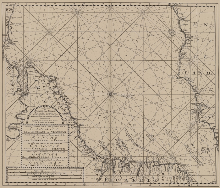
Van Keulen (1728, kaart 55)
Description Nieuwe Zeekaart Van t' Eerste Gedeelst Van t' canaal Tusschen Engeland en Vrankryk = Nouvelle Carte Marine pour la Premier partie de la Manche Entre Engleterre et France = the new Sea map of the First Part of the Chanell Betwext England et France = Nueva Carta Maritimas la Prima Parta del Canal Entre inglaterra y Francia = Nuova Carta maritima della Prima Parte del Canale Tra Inghilterra e Francia
Datum :1728
Plaats: Noord-Frankrijk, Zuidkust van Engeland, Het Kanaal
JPG file - 4.07 MB - 7 287 x 6 272 pixels
added on 2011-08-022 334 viewsMarine Gazetteer Places on this image:English ChannelEngland South CoastFrance Nord
From reference Voogt, C.J.; van Keulen, J. (1728). De Nieuwe Groote Lich... (page [188])
This work is licensed under a Creative Commons Attribution-NonCommercial-ShareAlike 4.0 International License