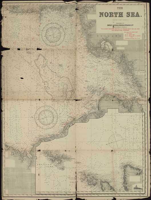
The North Sea
Description Britse kaart van het Noordzeegebied met aanduiding van o.a. de posities van wrakken, dieptes en zandbanken.
Coördinaten: 50°50’ NB - 61° NB; 5°30’ WL – 8°30’ OL
JPG file - 10.88 MB - 9 064 x 11 988 pixels
Extra information
FileName: 16002.jpg
FileDateTime: 1214297601
FileSize: 10883893
FileType: 2
MimeType: image/jpeg
SectionsFound: ANY_TAG, IFD0, THUMBNAIL, EXIF
COMPUTED.html: width="9064" height="11988"
COMPUTED.Height: 11988
COMPUTED.Width: 9064
COMPUTED.IsColor: 1
COMPUTED.ByteOrderMotorola: 1
COMPUTED.Thumbnail.FileType: 2
COMPUTED.Thumbnail.MimeType: image/jpeg
Orientation: 1
XResolution: 300/1
YResolution: 300/1
ResolutionUnit: 2
Software: Adobe Photoshop Elements 3.0 Windows
DateTime: 2008:06:23 16:14:00
Exif_IFD_Pointer: 172
ColorSpace: 65535
ExifImageWidth: 9064
ExifImageLength: 11988
added on 2008-06-241 125 viewsMarine Gazetteer Places on this image:North Sea
FileName: 16002.jpg
FileDateTime: 1214297601
FileSize: 10883893
FileType: 2
MimeType: image/jpeg
SectionsFound: ANY_TAG, IFD0, THUMBNAIL, EXIF
COMPUTED.html: width="9064" height="11988"
COMPUTED.Height: 11988
COMPUTED.Width: 9064
COMPUTED.IsColor: 1
COMPUTED.ByteOrderMotorola: 1
COMPUTED.Thumbnail.FileType: 2
COMPUTED.Thumbnail.MimeType: image/jpeg
Orientation: 1
XResolution: 300/1
YResolution: 300/1
ResolutionUnit: 2
Software: Adobe Photoshop Elements 3.0 Windows
DateTime: 2008:06:23 16:14:00
Exif_IFD_Pointer: 172
ColorSpace: 65535
ExifImageWidth: 9064
ExifImageLength: 11988
This work is licensed under a Creative Commons Attribution-NonCommercial-ShareAlike 4.0 International License