Blaeu (1612, kaart 01)
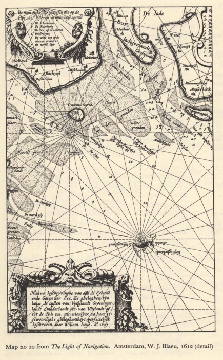
Description Nieuwe beschryvinghe van alle de Eylande ende Gaten der Zee, die gheleghen zyn langs de custen van Vrieslandt Groeninger landt Embderlandt etc van Vlielandt oa tot de Elve toe, nu nieulycx na hare jegewoordighe gheleghentheyt perfectelyck beschreven door Willem Iansz a° 1607
Benaminghe der plaetsen die op de Elve met letteren aenghewese werde
A. De Schortonne
B. De Rostonne
C. De ton op de Meem
D. De Grutpot
E. De witte ton op de nieuwe gronden
F. De noord Elve
Datum: 1607
Plaats: Duitsland
JPG file - 1.03 MB - 1 380 x 2 222 pixels
added on 2011-08-101 763 viewsMarine Gazetteer Places on this image:Germany
From reference Skelton, R.A.; Blaeu, W.J. (1964). The Light of Navigatio... (page [11])