Marine Gazetteer Placedetails
| MRGID | http://marineregions.org/mrgid/4336 | ||||||
| Status | Proposed standard |
||||||
| Name |
|
||||||
| PlaceType | IHO Sea Area | ||||||
| Latitude | 1° 15' 1.8" N (1.25050209°) | ||||||
| Longitude | 103° 57' 25.1" E (103.95696617°) | ||||||
| Precision | 74286 meter | ||||||
| Min. Lat | 1° 4' 18.2" N (1.0717°) | ||||||
| Min. Long | 103° 20' 44.5" E (103.3457°) | ||||||
| Max. Lat | 1° 42' 1.3" N (1.7004°) | ||||||
| Max. Long | 104° 34' 57.5" E (104.5826°) | ||||||
| Source | (1953). Limits of oceans and seas. 3rd edition. IHO Special Publication, 23. International Hydrographic Organization (IHO): Monaco. 38 pp. (look up in IMIS) | ||||||
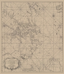
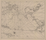
| Images |
|
||||||
| Relation |
|
||||||
| Map | |||||||
| Download |
Layer: MarineRegions:iho - format: |
||||||
| Shapefile | [download] or view the complete IHO Sea Area shapefile | ||||||
| Edit history | Last edited on 2017-01-18 17:22:03 by De Hauwere Nathalie | ||||||
| [Google] [Google scholar] [Google images] |


