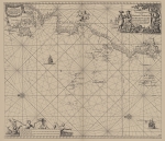
Marine Gazetteer Placedetails
| MRGID | http://marineregions.org/mrgid/14836 | |||||||||
| Status | Proposed standard |
|||||||||
| Names |
|
|||||||||
| PlaceType | Coast | |||||||||
| Latitude | 52° 15' 16.5" N (52.254588°) | |||||||||
| Longitude | 9° 49' 33.3" W (-9.825903°) | |||||||||
| Precision | 400000 meter | |||||||||
| Min. Lat | 51° 25' 10.8" N (51.4197°) | |||||||||
| Min. Long | 10° 39' 46.4" W (-10.6629°) | |||||||||
| Max. Lat | 55° 27' 1.4" N (55.4504°) | |||||||||
| Max. Long | 5° 59' 36.4" W (-5.9934°) | |||||||||
| Source | Masdea (look up in IMIS) | |||||||||
| Images |
|
|||||||||
| Relations |
|
|||||||||
| Map | ||||||||||
| Download |
Layer: MarineRegions:world_countries_coasts - format: |
|||||||||
| Edit history | Last edited on 2015-07-17 09:42:35 by De Hauwere Nathalie | |||||||||
| [Google] [Google scholar] [Google images] |


